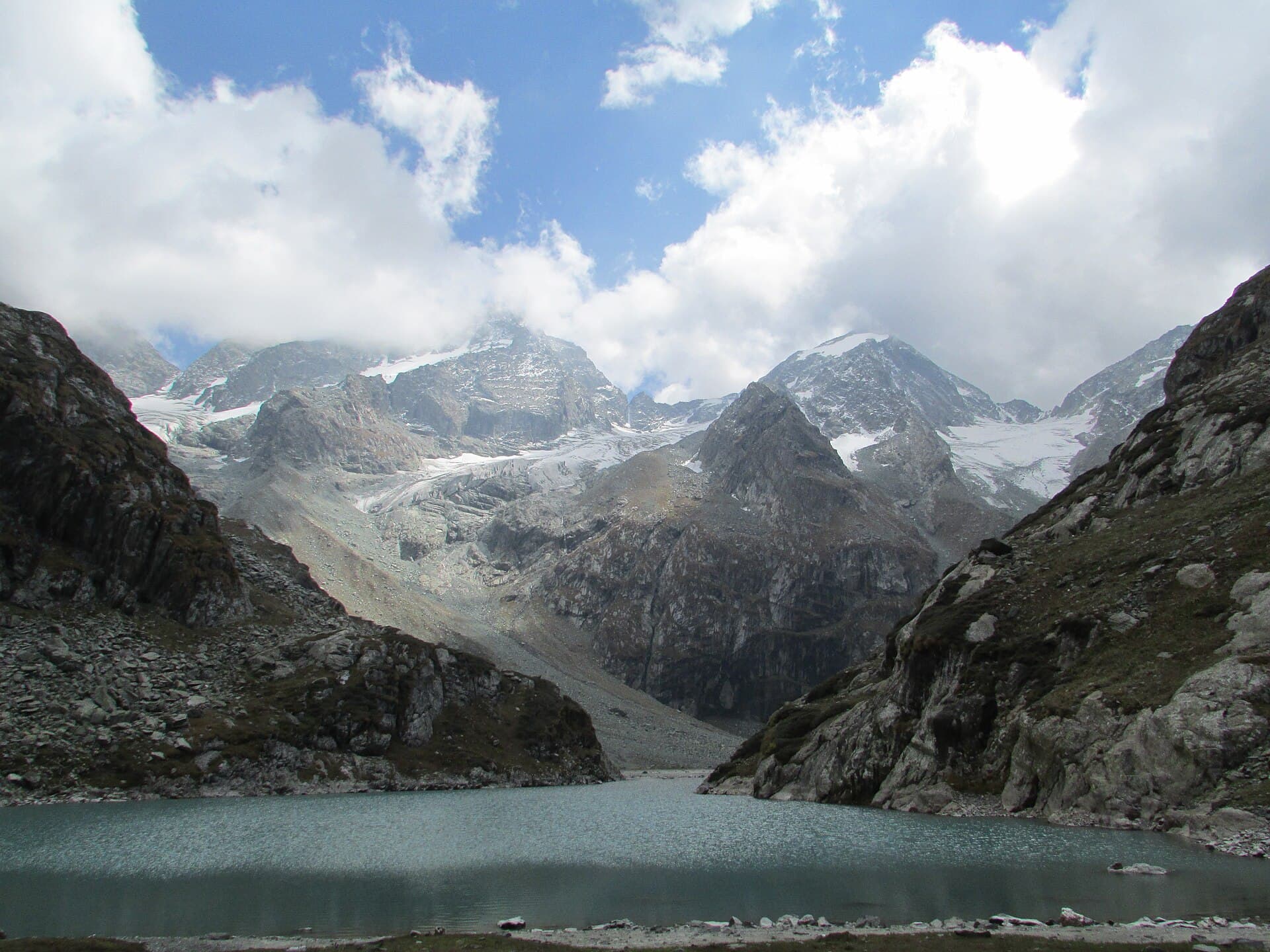
Tulian Lake Trek
A high-altitude glacial lake above Baisaran, usually done as a demanding 2-day trek from Pahalgam
No reason has been recorded. Closures here are usually snow, a damaged crossing, or an order restricting access — check locally before you travel.
Closed · 1–2 days
- 1–2 days
- Duration
Season window
The trail opens well before the lake does — May and early June are walkable, but you arrive at a lake still frozen with snow lying in the valley, so "open" and "worth the walk for the view" are several weeks apart here.
Next in season from September.
Route & trail
No surveyed route yet.
This trek has not been digitised, so there is no map, no elevation profile and no checkpoint list for it. Everything else on this page is editor-checked information about the walk itself.
Safety & conditions
Permits
No independently-obtainable named permit is documented. Indiahikes lists no permit requirement; one operator states a "Forest Permit and entrance fee" is mandatory but names no authority and no fee, and others simply fold permits into the package price. Carry a government photo ID. Pahalgam-area trails fall under the **Pahalgam Development Authority**, and registration at **Pahalgam Police Station** is required for some routes in the area — confirm locally. **Access note:** this record starts the trek at Baisaran. Baisaran was not among the tourist destinations J&K listed as reopened in February 2026, and its access status is not clearly resolved in published sources. The alternative Ganesh Bal start used by several operators is not affected by that question. Verify the start point locally before publishing directions.
NOT OFFICIALLY VERIFIED — CONFIRM BEFORE YOU TRAVEL
Getting there
Gear checklist
0 / 25CLOTHING
GEAR
SAFETY
MEDICAL
The Kashmir Explorer app keeps the same checklist on your account and inside the offline Trek Pack.
About this trek
Tulian Lake sits at nearly 3,684 metres in a rocky bowl about 16 kilometres southwest of Pahalgam, reached via the Baisaran meadow and Zomarod ridge. The trail climbs through pine forest into open meadow before a steep, rocky final push to the lake, which often holds floating ice even in summer. Most parties camp overnight partway up and treat it as a two-day round trip from Pahalgam.
Photographs
No trekker reports yet.
Conditions on this route change week to week. If you walk it, a short report on pass snow and river levels genuinely helps the next group — reports are posted from the Kashmir Explorer app.
Where this data comes from
On the trail
The Kashmir Explorer app is where a trek stops being a page and starts being a walk.
- Offline Trek PackRoute, checkpoints, itinerary, safety, permits, gear and a corridor of map tiles, downloaded to your phone.
- Offline GPS navigationFollow the route with no signal, with your position on the line.
- Live trek sessionStart the trek, track progress checkpoint by checkpoint, and pick it up where you left off.
- Off-route alertsThe app watches your GPS against the route and warns you when you drift off it.
Prepare this trek on your phone before you leave signal. The trek, the route and the numbers are identical to this page — one catalogue, one Official Route.